 University Library
Sources of Inquiry
 University Library
Sources of Inquiry
Maps are graphic representations of the Earth's features, and can serve as visual narratives that tell stories about places and the people who lived in them at particular times. We often think of maps as scientifically-designed instruments, but mapmaking is selective and subject to the cartographer's motives, biases, and goals, whether the map produced is political, physical, topographic, climatological, economic, or thematic.
On display is the Geographisch Handtbuch, a world atlas produced in 1600 based on the world's first modern atlas printed 30 years before. Goode's School Atlas contains maps detailing the physical, political, topographic, climate, and economic characteristics of various nations in the early 20th century, many of which no longer exist. "The 5th Column Menaces America on a Thousand Fronts" is a thematic map produced by the Constitutional Educational League, an American anti-communist organization founded during a wave of Red Scare in the 1920s. It depicts concentrations of Nazis, Communists, and Fascists across the United States. The Map of Territory Annexed to the City of Los Angeles documents the communities that were annexed or consolidated into Los Angeles between 1839 and 1928, including their original names and sizes.
Physical maps document the natural environment. They show mountain ranges, rivers, and lakes, but can include man-made locations as well. The Land Classification Map of Part of Southern California was part of an annual report that surveyed states west of the 100th meridian beginning in 1864. The Monte Vista Tract Map is both a thematic map and an advertisement for real estate in present-day Tujunga, and the Mulholland Family Properties Map shows changes and revisions to personal property over time.
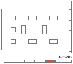
Case 16, Posters and Flyers, is located to the right.
1
Monte Vista Tract Map, circa 1885California Tourism and Promotional Literature Collection
2
Quad, Matthias. Geographisch Handtbuch: In Welchem Die Gelegenheit Der Vornembsten Landschafften Des Gantzen Erdtbodems in Zwej Und Achtzig in Kupffer Geschnittenen Taffeln Furgebildt. Köln: Johann Buxemacher, 1600.G 120 T63
3
Goode, J. Paul. Goode's School Atlas: Physical, Political, and Economic, for American Schools and Colleges. Chicago: Rand McNally & Company, 1923.G 1019 G67 1923
4
Mulholland Family Properties Map, circa 1985Catherine Mulholland Collection
5
"The 5th Column Menaces America on a Thousand Fronts," 1941Jewish Federation Council of Greater Los Angeles, Community Relations Committee Collection, Part 2
6
Shaw, John C. Map of Territory Annexed to the City of Los Angeles, California. Los Angeles, CA: Los Angeles Board of Public Works, 1928.G 4364 L6 1928 S52
7
Land Classification Map of Part of Southern California, U.S. Geographical Surveys West of the United States 100th Meridian. Washington, D.C.: United States Army Corps of Engineers, 1879.G 4363 K4J1 1879 G46
