Map Collection History
Map Library History
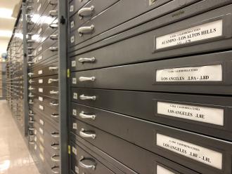
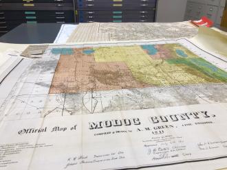
The University Library Map Collection (née Geography Map Library) was established in 1958 by Dr. Robert Lamb within the Geography Department at CSUN, then known as San Fernando Valley State College. Recognizing the instructional value of maps to geographers and cartographers, Dr. Lamb created the Map Library to support student and faculty research within the department. The Map Curator position was also created to manage the maps and provide access to and research support for the department’s rapidly-growing cartographic collections. The Map Library became a depository for the Army Map Service (AMS) in 1958, and AMS maps represented some of the Map Library’s first cartographic holdings. Holdings expanded significantly when graduate student Ken Kearsley conducted an internship at the Library of Congress in 1959 and negotiated the acquisition of a large collection of duplicate California fire insurance maps. In 1962, the Map Library became a depository library for the U.S. Geological Survey resulting in the deposit of tens of thousands of topographic maps over the next several decades. In addition to deposits and acquisitions, the collection has also grown over the years through generous faculty and individual donations and gifts.
The Map Library and Geography Department were originally located on the third floor of the campus's first Library building, which opened to students in 1959. The Map Library then moved to the old Fine Arts building--since demolished--sometime before 1962. In fall 1963, the Map Library was then relocated to the brand new Sierra Hall building. In 1993, the Map Library, overflowing with maps and equipment, expanded into two new larger spaces in Sierra Hall. In September 2017, administration and oversight of the Map Library was transferred to the main Oviatt Library organization. In January 2019, the map collection and staff relocated to the University Library (née Oviatt Library) where it will continue to provide cartographic research support for faculty and students across campus.
Map Curators
Vincent Mazzucchelli served as the library’s first Map Curator from 1958-1962. Mazzucchelli became a Geography faculty member in the fall of 1960 and continued managing the Map Library until about 1962. According to Bill Miller, a Geography student and former Map Library assistant in the early 1960s, the Map Library was managed by a group of graduate students between 1962-1964. Wallace “Sarge” St. Clair served as Map Curator to the collection from 1965-1970. Gary Rees served as Map Curator from 1970-1975. Michael Swift served as Map Curator from 1976-2005. Swift brought the Map Library into the computer age when he secured one of the department’s first computers in order to begin cataloging resources in an electronic database. Kris Tacsik, who had served as Assistant Map Curator from 1983-2005, took over as Map Curator from 2005-2014. Tacsik helped modernize the Map Library by introducing new technologies and equipment allowing patrons to digitize and print maps. Chris Salvano served as Map Curator from 2015-2022. He brought a research librarian and special collections background to the Map Collection. Salvano expanded GIS research support services within the library and managed the collection's physical and administrative transition into the University Library.