About the University Library Map Collection
Overview
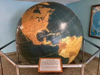
The Library Map Collection at California State University, Northridge (CSUN) holds a research-level collection of approximately 400,000 historical and government maps, aerial photographs, atlases, and geospatial data that support research on campus. While holdings are international in scope, the collection emphasizes Western Americana, particularly maps of California, Los Angeles County, and the San Fernando Valley. Patrons can find primary and secondary resources like historical road and tourist maps, planning and zoning maps, topographic maps, geologic and bathymetric maps, WWII maps from the Army Map Service, and maps from other federal agencies like the USGS, the Bureau of Land Management, and the U.S. National Park Service.
The Map Collection is a comprehensive service point whose staff provides subject expertise in cartographic resources, general and complex reference services, instructional assistance, and GIS research & technical support. The Map Collection Reading Room (Library 26) is an open study space available to all patrons and includes a scholarly collection of books and atlases available for browsing only. If you have research questions or inquiries related to cartographic resources, GIS, ArcMap, or using maps as primary resources, please call 818-677-3465 or email librarymaps@csun.edu.
Using the Map Collection
The Map Collection adheres to all applicable University Library policies. Some additional policies are outlined below.
Reading Room Collection (Books, Atlases, & Reference)
The books and atlases within the reading room are cataloged and can be searched in OneSearch. Materials are non-circulating and may be used within the reading room during normal business hours.
Government Documents Collections
The Map Collection is a selective participant in the Federal Depository Library Program (FDLP) and holds government maps from the United States Geological Survey (USGS), the Bureau of Land Management (BLM), the Army Mapping Service (AMS), National Park Service (NPS), among others. Access to government documents is guaranteed by public law (Title 44 United States Code). Please contact Map Collection staff for research assistance and to access the collections.
Other Cartographic Collections
Most other cartographic collections (historical maps, aerial photos) are maintained in closed stacks and are accessible by appointment with an established research purpose. Please contact Map Collection staff to set up a research consultation.
Food & Beverage
Food and beverages in secure lidded contains are permitted in the Library. However, food and beverage is not permitted at tables where cartographic collections are being used or displayed. No food or drinks are permitted in the staff processing areas or in the closed stacks area of the Map Collection. Tobacco products, including electronic cigarettes, are prohibited.
Noise
The Map Collection Reading Room is considered a collaborative space where noise levels will vary due to group study and interactions at the service desk. Please follow other noise policies outlined by the University Library:
- Be considerate of others and use a conversational "indoor" tone of voice
- No party atmosphere, yelling, or shouting
- Set cell phones to vibrate
- Use headphones with personal media