Government Document Maps
Abstract
The University Library Map Collection has been member of the Federal Depository Library Program (FDLP) since 1958 and holds government maps from the United States Geological Survey (USGS), the Bureau of Land Management (BLM), the National Park Service (NPS), and the Army Map Service (AMS), among others. Government maps include topographic, bathymetric, land management, and geologic maps. FDLP maps are public documents and access to these materials is always guaranteed public law (Title 44 United States Code). Read more about the FDLP.
To access the collection, please contact Map Collection staff.
Core Collections
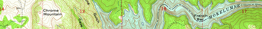
USGS Topographic Map Collection
- Los Angeles County 6-minute series (1:24,000)
- The USGS produced a special series of topographic maps of Los Angeles County from the 1920s through the early 1950s. These maps show early 20th century physical and cultural features of LA County.
- 7.5-minute series (1:24,000)
- 7.5x15-minute series (1:25,000)
- Historical 7.5-minute series (1:31,680)
- 15-minute series (1:62,500)
- USGS 30x60-minute series (1:100,000)
- BLM 30x60-minute series (1:100,000)
- Alaska series (1:25,000 / 1:63,360 / 1:250,000)
- United States series (1:250,000)
- Puerto Rico series (1:20,000 / 1:30,000)
- USGS Orthophotoquad series (1:24,000)
- County map series (1:50,000 / 1:100,000)
- International Map of the World (1:1,000,000)--selected sheets
- Other historical mapping programs like the historical 1-degree series (1:250,000), 30-minute series (1:125,000)
- Bureau of Land Management (BLM) Map Collection
- National Park Service (NPS) maps
- Army Map Service (AMS) maps
- USGS Geologic Atlas of the United States (selected folios)
- Geologic Sheet Maps of Southern California (USGS, CGS)